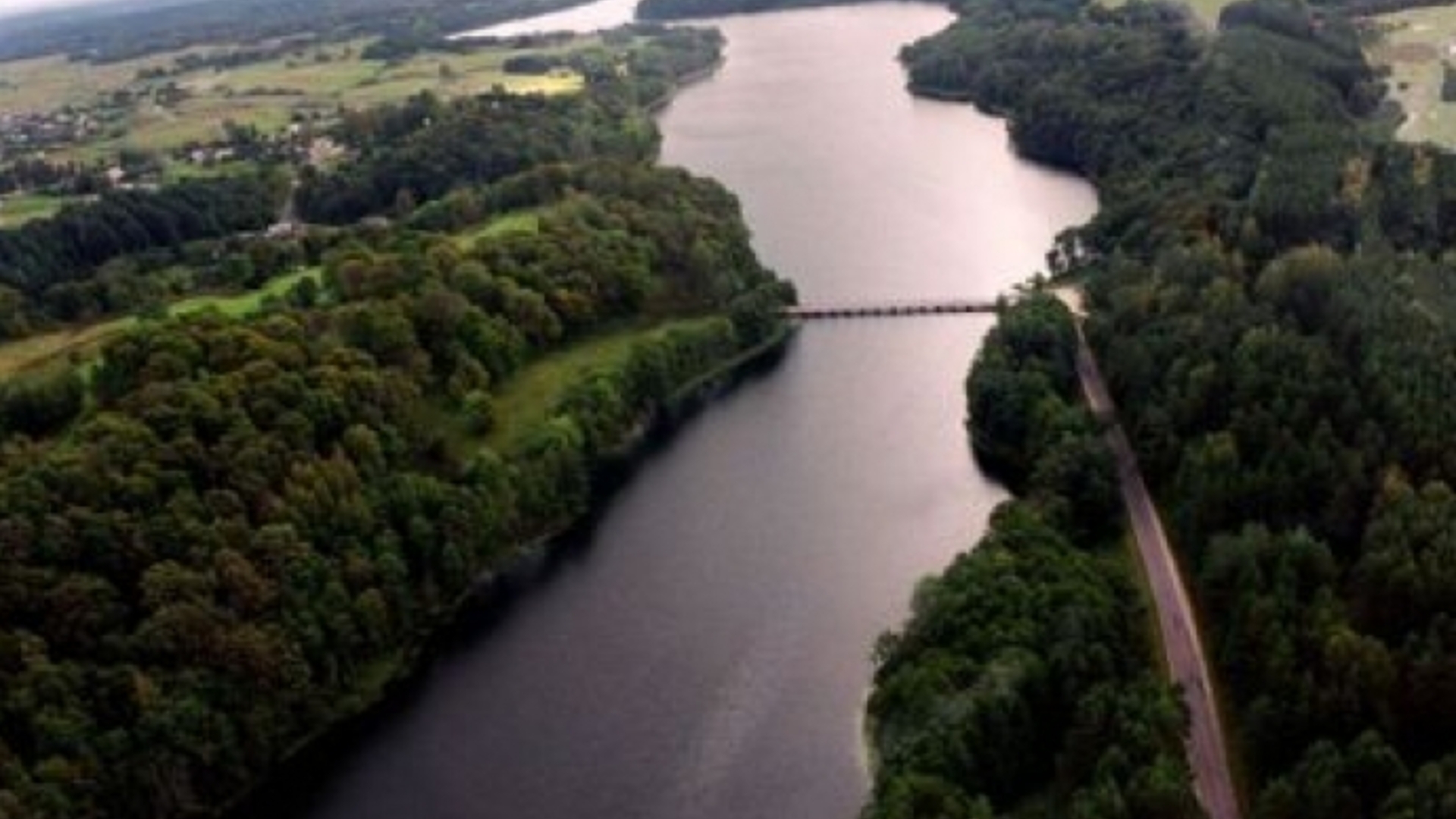
Start of the route: the parking lot near Dubingiai Bridge (object of cultural heritage). GPS: 55.056791 25.443327
The Dubingiai castle site, located on the peninsula of Lake Asveja, which used to be an island, is one of the 50 firmly identified castle sites in Lithuania (one of the largest in terms of area). The length of the hill is ~500 m, the width at the eastern end is ~100 m, at the western end ~200 m. Dubingiai castle site, declared a cultural monument of Lithuania, is the most prominent cultural value of Asveja Regional Park and the entire Dubingiai region. Dubingiai castle site is an exceptional object of Lithuanian history, archaeology and memorial heritage. GPS: 55.057572 25.444395
Liudgardas campsite. In the campsite, located in the forest of Dubingiai, in the recreational area of Liudgardas, you can rest and camp overnight. GPS: 55.046085 25.513709
Vainikų Island (Jonėnai Castle Mound) The Jonėnai Castle Mound is located on the 2,3 ha Vainikų Island of Lake Asveja. An oval-shaped site with pointed ends, elongated in the W-E direction, up to 1 m high with a raised middle, 1-1,5 m lower edges, size 170x30 m. The slopes are steep, 10-11 m high. Striped pottery was found in the mound. The mound dates back to the beginning of the 1st millennium. GPS: 55.042016 25.506005
Lake Asveja observation deck. The deck is located in the Purviniškiai Forestry of the Nemenčinė Forest Office. A variety of recreation methods are available. Convenient exit for water tourists, equipped with wooden stairs. GPS: 55.036335 25.537376
Žingiai campsite. The campsite is located in Vilnius district, in Sužioniai subdistrict. A variety of recreation ways are possible, convenient disembarkation for water tourists. GPS: 55.012399 25.578446
Purviniškiai pine. Natural heritage site. The pine stands on the northern shore of Lake Asveja. With its majestic woody trunk and gnarled branches, it has preserved the history of Šakymas forest for ~350 years. The tree, unable to bear the burden of all it’s years, withered in 1998-1999. Convenient exit for tourists, equipped with wooden stairs to the slope. GPS: 55.008536 25.592222
Bieliškiai island. The island is located in Lake Asveja. According to archaeologists, the former old settlement dates back to the beginning of the 1st millennium. GPS: 55.000611 25.595655
Dubinga River. The largest river in the park is Dubinga, the right tributary of Žeimena. The river is characterized by how winding it is, and by the mature forests rustling along the banks. This river frequently enchants tourists with its appeal and mystery, hiding its sources in a dense swamp in Vyriogala Bay, Lake Asveja. A few kilometers away, Dubinga flows into the Pabradė pond, so water tourists will have to carry their boats and kayaks over the dam. After flowing for about a couple of kilometers, the stream calmly flows into one of the rivers – Žeimena. The slope of Dubinga is quite high — 1,4 m, the length is about 18 km. GPS: 55.007379 25.614796